Know what is on your ground, and what is changing on it.
We analyse satellite data for any lease, licence or mine to map altered rock and drill targets, track pits and dumps, measure slope movement and detect illegal digging. Send corner coordinates, a shapefile or a photo of the lease plan. You receive maps, ranked targets and GIS files within days.
Fixed quote within 48 hours. Nothing to pay until you accept it.
Services
Each service answers one question. Choose the description that fits you to see the relevant services, each with an example result.
Not sure which fits? Tell us the decision you need to make and we choose the analyses.
You hold a lease or block and want to know what is on it, and whether anyone is digging on it without permission.
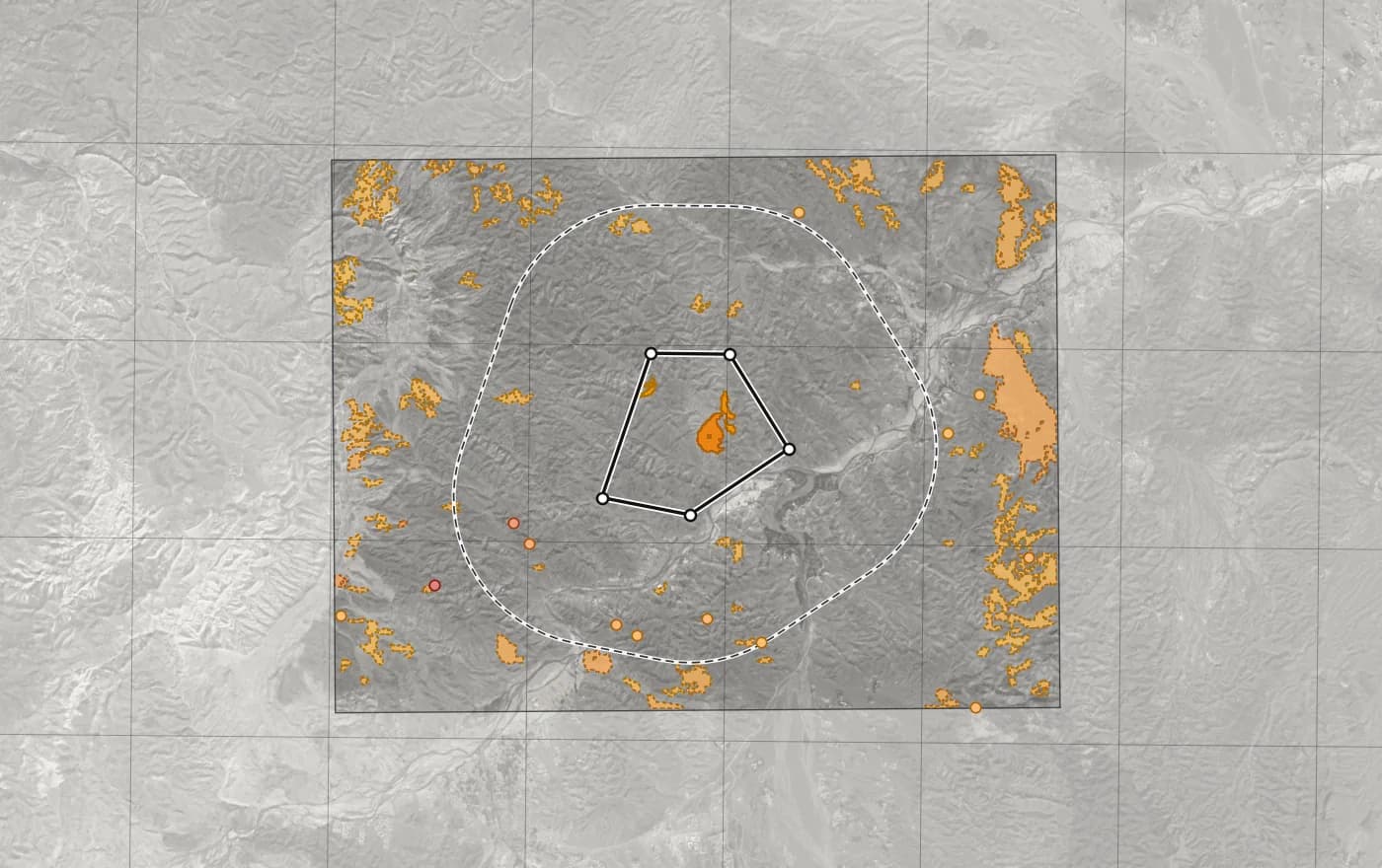
Anomaly spots page from a sample lease map pack. Spots were searched inside the darker rectangle. Spot 4, the top ranked spot inside the lease, sits at 2 907 841 E, 965 095 N on the Survey of Pakistan grid. 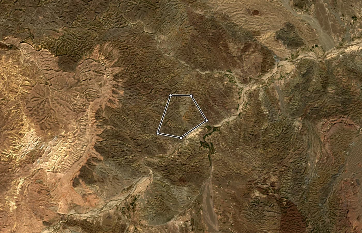
Corner coordinates Decimal degrees, WGS 84 Degrees, minutes, seconds Pakistan grid, Kalianpur 1962 zone I (EPSG:24376) Corner Latitude Longitude Latitude Longitude Easting (m) Northing (m) A 32.952622 69.756343 32°57′09.44″N 69°45′22.83″E 2 907 224.33 965 920.11 B 32.952483 69.764882 32°57′08.94″N 69°45′53.57″E 2 908 021.91 965 917.89 C 32.943778 69.771180 32°56′37.60″N 69°46′16.25″E 2 908 626.10 964 963.51 D 32.937829 69.760436 32°56′16.18″N 69°45′37.57″E 2 907 633.57 964 287.94 E 32.939454 69.750906 32°56′22.03″N 69°45′03.26″E 2 906 740.60 964 453.30 Cover page of the same pack: corners A to E in three coordinate systems, as pasted from the lease plan. Lease map pack
What is on my lease, and where should I look first?
Satellite maps clipped to your lease, the strongest mineral signals inside and around it, and your corner coordinates in Pakistan grid and lat/long, checked against the area on your lease document.
About a weekTypical area 1 to 50 km²What you get
Map packPDF, PNG
Natural colour, geology, iron oxide, clay, vegetation and elevation pages of your lease, with grid, scale and north arrow, ready to print on A4 or A3.
Anomaly spotsCSV, GeoPackage
Each spot in and around the lease ranked by strength, with its centre in lat/long and Pakistan grid.
Corner coordinatesCSV
Lease corners in Pakistan grid and lat/long, and the area we measured next to the area on your plan.
We need corner coordinates from the lease plan, or a clear photo or scan of the plan; the lease number and district; the mineral the lease is for, if you know it.
Request a lease map packFixed quote within 48 hours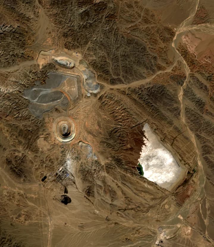
Autumn 2019, 25 October. 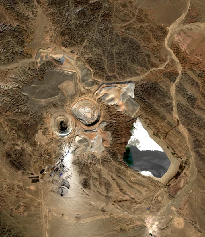
Autumn 2026, 23 October. Same season, same view: a new pit at the centre and new dumps to its north-east. Illegal digging watch
Is anyone digging on my lease without permission?
Every month we compare your lease with the same season a year earlier, so floods, crops and snow do not set off false alarms, and flag new pits, spoil heaps and tracks inside your boundary and around it.
First check in about a week, then monthlyTypical area 1 to 100 km², plus the bufferWhat you get
Monthly checkPDF
New excavation and tracks inside the lease and in a buffer around it, usually 2 km.
Evidence imagesPDF, KML
Before and after images of each incident, with its position in Pakistan grid and lat/long.
Alert
Sent when a new incident appears, so you can respond quickly.
We need the lease boundary; where your own crews work, so their digging is not reported; known trouble spots and who holds the ground next door.
Your quote states the smallest disturbance each check will pick up.
Request a digging watchFixed quote within 48 hours, per month or per quarter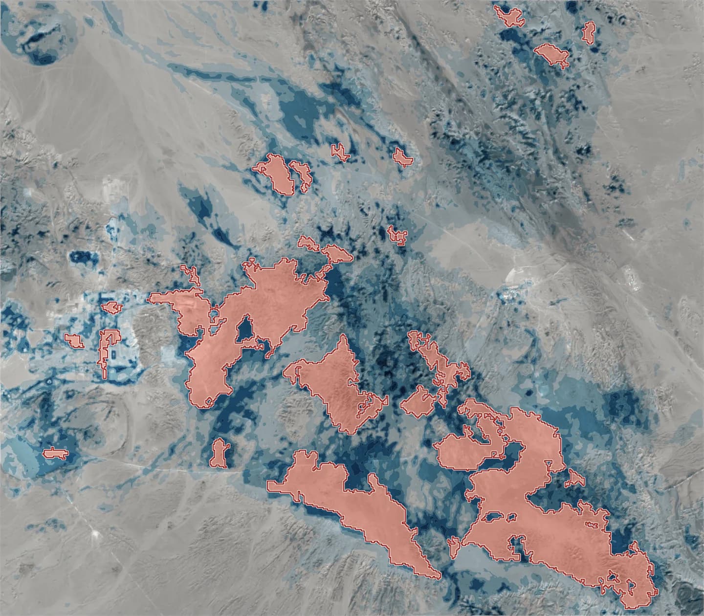
Ranked targets over the Reko Diq area. Darker blue is higher combined prospectivity. Red areas are targets; the ten highest are numbered, 1 first. Target generation for exploration
Where on this licence should the field crew go first?
We map altered rock, minerals and faults across your licence and combine them into a ranked list of targets.
About a weekTypical area 10 to 400 km²What you get
Ranked targetsPDF, GeoPackage, KML
Every target numbered by score and outlined, with the evidence behind it and what to check first in the field.
Alteration and mineral mapsGeoTIFF
Clay, white mica and iron oxide mapped across the licence.
Fault mapGeoPackage, Shapefile
Likely faults traced from the shape of the land, and where they cluster and cross.
Access to targetsGeoPackage
Tracks found in recent images and the easiest routes from them to the top targets.
We need the licence outline: coordinates, a shapefile, KML or a scan of the plan; the commodity or deposit type you are after; known showings, samples or old workings, if you have them.
Works best on bare rock in dry ground. Thick soil, sand cover, crops or forest hide the surface signs.
Request target generationFixed quote within 48 hours
You have a licence and a field season to plan.
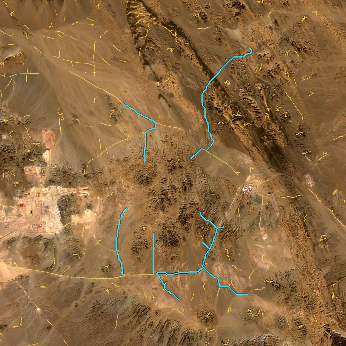
Near Reko Diq: tracks found in recent images in yellow, and the routes we planned along them to the ten top targets in cyan. Access and logistics planning
How do we get the crew and the rig to the targets?
We map dirt tracks that are missing from existing maps using recent satellite images, plan the easiest routes from them to your targets, and rank flat, dry sites for a camp and drill pads.
Three to five daysTypical area 10 to 400 km²What you get
Track mapGeoPackage, KML
Tracks and roads found in recent images, with the date of the image.
Routes to targetsGeoPackage, KML, PDF
The easiest route to each target that avoids steep slopes, with its length.
Camp and pad sitesGeoPackage
Ranked by slope, flatness, distance to a track and distance from drainage lines.
We need the area and the targets, ours or yours; your starting point or base camp; the vehicles you will use.
Request access planningFixed quote within 48 hours
You are weighing a project you cannot easily visit.
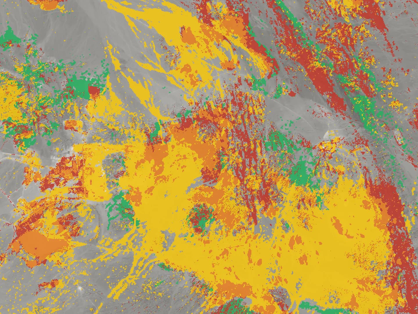
Alteration classes over the Reko Diq area: iron oxide in red, clay and white mica in yellow, both in orange, Mg-OH or carbonate in green. Project due diligence for investors
Does the ground support what the vendor says?
We review satellite data for the project and report which claims it supports, which it does not, and what needs further checking. The review covers alteration and targets, signs of activity, and environmental red flags. We work for you, not the vendor.
About a week per projectTypical area 5 to 200 km²What you get
Due diligence reportPDF
A plain summary for your investment committee, with the map behind every finding.
Alteration and target checkMaps, GIS files
Whether the claimed alteration shows in satellite data, and whether the strongest zones match the location of the claimed resource.
Activity checkDated images
Whether pits, dumps, roads and camps are changing, shown in dated images going back several years.
ESG red flagsMaps, CSV
Vegetation loss, surface water, dust sources and disturbance outside the licence, marked for follow-up.
We need the project name and location, or the licence plan; the decision you face and when you must make it; the vendor's claims or technical report, if you can share them under NDA.
Request due diligenceFixed quote within 48 hours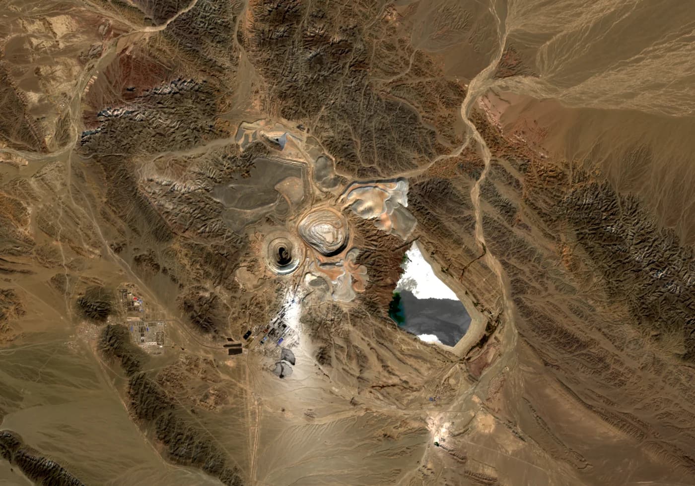
Saindak copper mine, Chagai, 23 October 2026. Mine site monitoring
How did every pit, dump and stockpile change this month?
We measure the footprint of pits, dumps, haul roads and stockpile yards on satellite images every month, and report the change in hectares with a map of what moved.
First report in about a week, then monthlyTypical area 1 to 100 km² per siteWhat you get
Monthly site reportPDF
Change in pit, dump, road and stockpile footprints since last month, in hectares, with maps.
Change outlinesGeoPackage, Shapefile
New disturbance outlined and dated, for your own GIS.
Footprint seriesCSV, charts
Area of each feature at every date, so you can see whether the site is expanding or inactive.
We need the site outline or coordinates; what you want watched most closely; the date to start from.
Request site monitoringFixed quote within 48 hours, per month or per quarter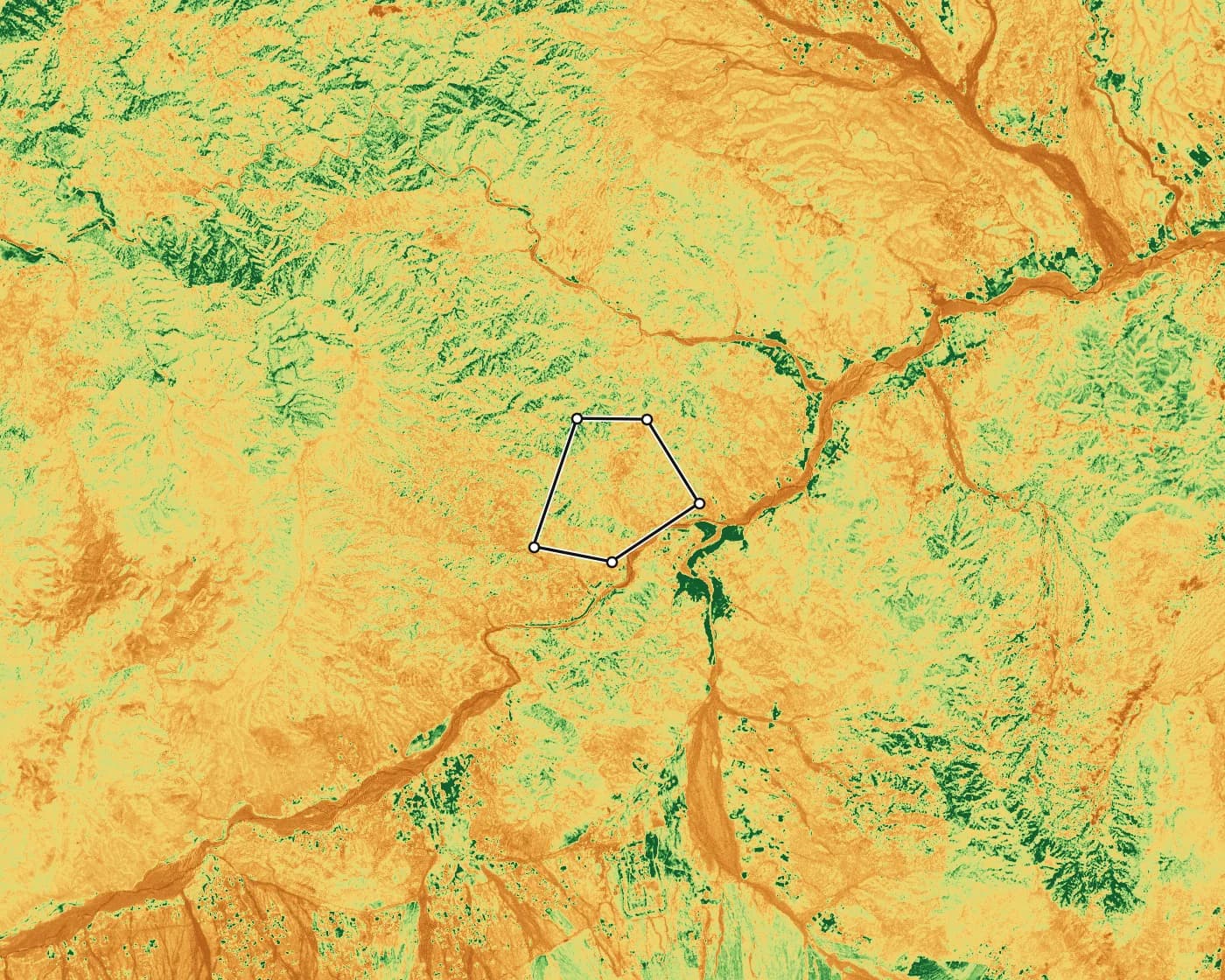
Vegetation page from a sample lease map pack. Green is growing plants; yellow and orange are bare rock, dry soil or sand. Environmental and ESG check
What has happened to vegetation, water and land around the site?
Five years of vegetation, surface water, dust sources and bare ground around your site, and which disturbed ground is recovering, measured the same way every year.
About a weekTypical area 5 to 500 km²What you get
ESG layersGeoTIFF, CSV
Vegetation, surface water, dust source and bare ground trends over five years.
Disturbed and rehabilitated groundGeoPackage, CSV
Where land was cleared and where plants are returning, in hectares per year.
Numbers for your reportPDF, CSV
A short table of yearly figures and maps you can paste into a sustainability report.
We need the site outline and how much of the surroundings to include; the reporting period; areas you have rehabilitated, if any.
Request an ESG checkFixed quote within 48 hours
You run a mine or quarry and need numbers every month.
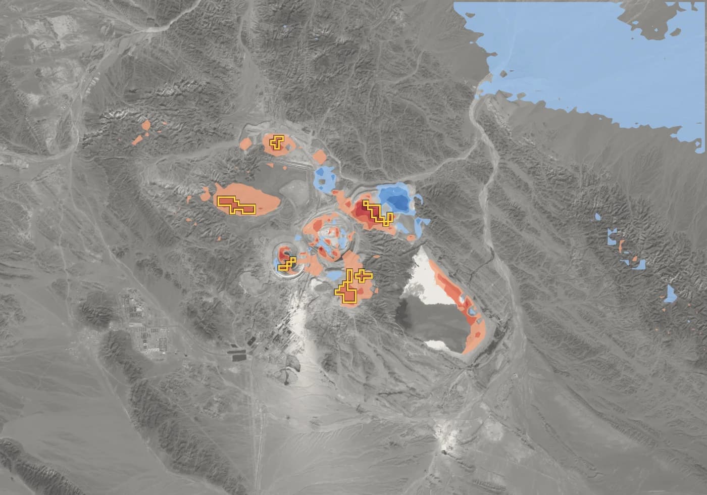
Ground movement at Saindak copper mine, November 2025 to October 2026. Red and blue show movement in opposite directions, relative to the area as a whole; colour starts at 5 mm a year. Yellow outlines are accelerating ground. Ground movement monitoring
Is any slope, pit wall or tailings dam moving, and is it speeding up?
We measure ground movement to a few millimetres. We map it on slopes, pit walls, dumps and tailings, update it every month, and alert you when an area moves faster than your limit and is speeding up.
Baseline in one to two weeks, then monthlyTypical area 5 to 200 km²What you get
Movement mapGeoTIFF, CSV
Movement in millimetres per year on pit walls, dumps and tailings, point by point.
Monthly updatePDF
The latest measurements added to the series, with a short note on what changed.
Acceleration alerts
Sent when ground moves faster than your limit and is speeding up, with its time series.
We need the site outline; the slopes, dams or areas that matter most; your alert limit, if you have one.
An alert is a prompt for geotechnical inspection, not a stability assessment. It adds to your instruments and inspections; it does not replace them.
Request ground movement monitoringFixed quote within 48 hours, per month or per quarter
You need satellite layers for your own bid or report.
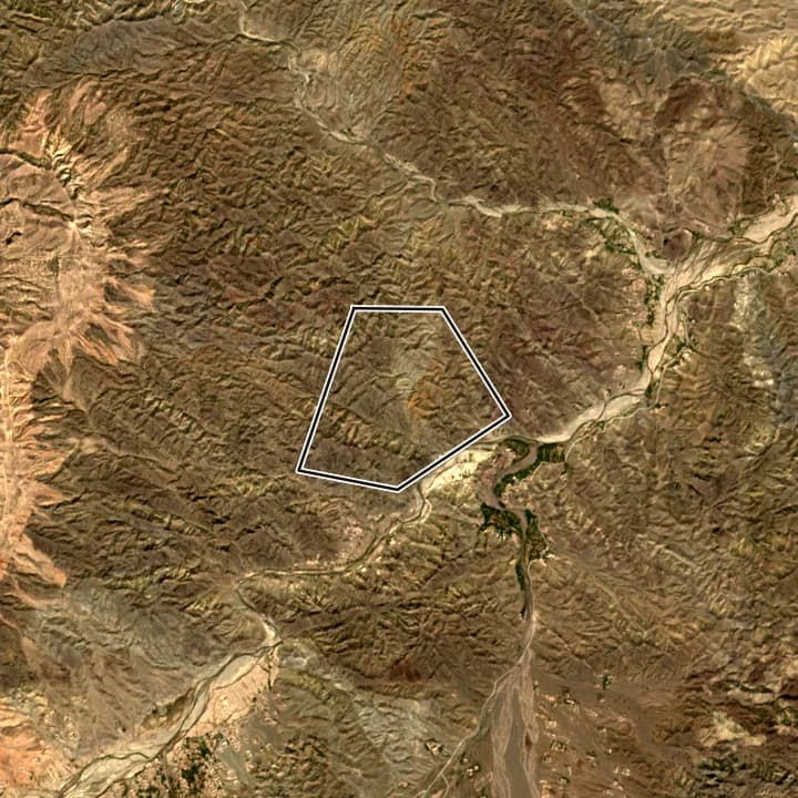
Natural colour 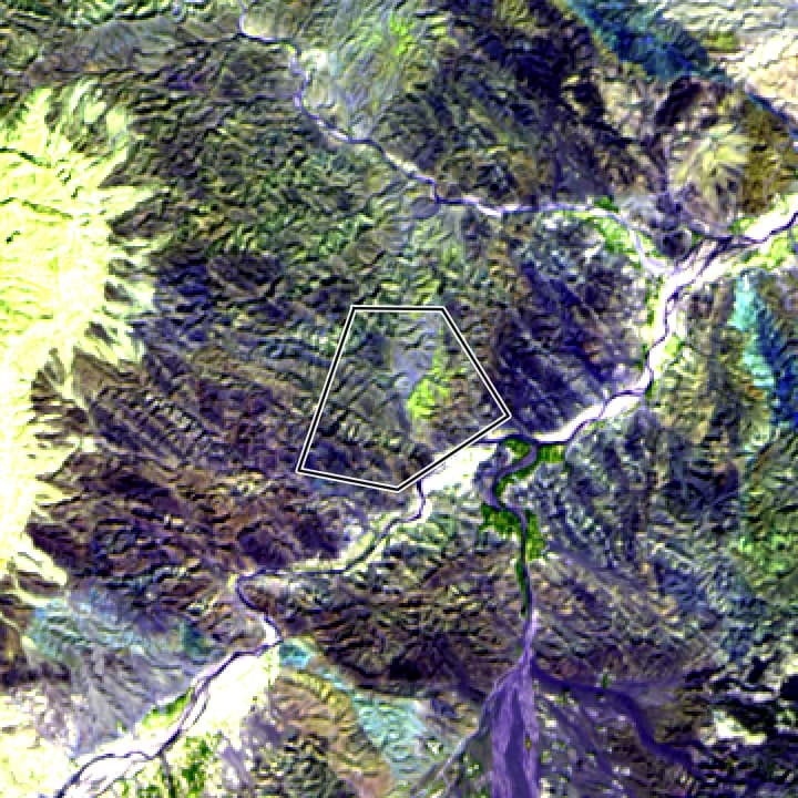
Geology composite 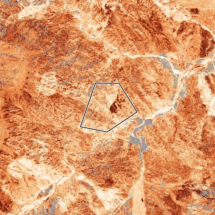
Iron oxide 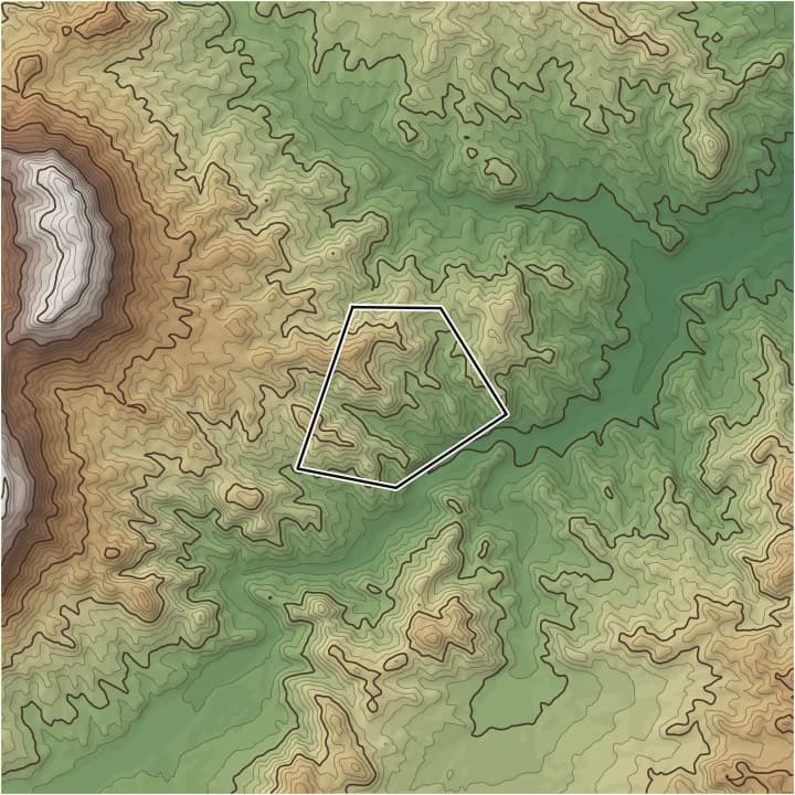
Elevation Custom work and white-label
Can you supply satellite layers for our bid, under our name?
Mineral, terrain, change and ground movement layers for your bid or project, in your coordinate system and map style. Deliverables carry your name, not ours.
Agreed per job, often a few daysTypical area AnyWhat you get
Unbranded mapsPDF, PNG
In your template, or with no branding at all.
GIS layersGeoTIFF, GeoPackage, Shapefile
In your project coordinate system, ready for your GIS team to style.
Methods and limits text
A short section on data, method and limits to paste into your proposal.
We need the area; the layers or the question; your template and coordinate system.
Tell us what you needFixed quote within 48 hours
How it works
- Step 1
Send us the area
Corner coordinates in any format, a shapefile or KML, or a photo of the lease plan. Pakistan grid coordinates can be pasted as written.
- Step 2
Get a fixed quote within 48 hours
We check the area, choose the analyses that answer your question, and send one price. Nothing to pay until you accept it.
- Step 3
We analyse your area
Our team processes the satellite data over your area. Every map is reviewed by our geologists before release.
- Step 4
You get maps, targets and GIS files in days
A map pack to print, GIS files for your team, and a written report if you want one.
Reviewed by a team of experienced and qualified geologists and experts.
Questions
Something else? Ask on WhatsApp or at info@halbergmining.com.
How much does it cost?
Every area is different, so we quote per area. Send the area and what you want to know, and we reply with a fixed price within 48 hours. Nothing is charged until you accept the quote.
I am not a geologist. Can I still use this?
Yes. Tell us the decision you face, and we choose the analyses. Every map comes with a plain explanation of what the colours mean, and we go through the results with you on a call or on WhatsApp.
What do you need from me to start?
The area. Corner coordinates, a shapefile, KML or GeoJSON, or a clear photo of the lease plan all work. Pakistan grid coordinates can be pasted as they are written on the plan. Field samples, geology maps or drill holes help, but we can start without them.
Will this find a deposit?
Satellite data cannot confirm a deposit. We find surface signs that often sit over ore, such as altered rock and faults, and rank where to look. You confirm them on the ground with mapping, sampling and drilling. Our results are targets for field verification, not resource or reserve estimates.
Does it work outside Pakistan?
Yes. We work on areas anywhere in the world. For Pakistan we also accept Survey of Pakistan grid coordinates and local place names.
Is my information kept confidential?
Yes. We sign your NDA on request. Results go only to the people you name. Investors can ask us to look at a project without telling the vendor.
What exactly will I receive?
A map pack PDF, a written report if you want one, GIS files (GeoTIFF, GeoPackage, Shapefile, KML) and, if you want it, a call to go through the results. Monitoring adds a monthly update and alerts.
How fast is it?
Most one-off studies take about a week after you accept the quote. Monitoring starts with a baseline in one to two weeks, then monthly updates.
How detailed are the maps?
We choose the right imagery for each job. Detail depends on the job and is agreed in the quote.
Get a quote
Send the area as coordinates, a shapefile or a photo of the lease plan, or send it later. We reply with a fixed quote within 48 hours.
Results are targets for field verification, not resource or reserve estimates.